
Bloomington ZIP Code Coverage
The Census Bureau identifies six ZIP Code Tabulation Areas associated with Bloomington. A ZCTA is a census approximation built from blocks, not the Postal Service's live delivery boundary. The research does not support assigning firm neighborhood borders or a named post office to every row, so the coverage table stays precise about what is known.
| ZIP | Documented association | Best official check | Research note |
|---|---|---|---|
| 47401 | Bloomington-associated ZCTA | USPS exact-address lookup | Do not infer city limits |
| 47403 | Bloomington-associated ZCTA | USPS exact-address lookup | Compare parcel geography |
| 47404 | Bloomington-associated ZCTA | USPS exact-address lookup | Mailing city is not jurisdiction |
| 47405 | Bloomington-associated ZCTA | USPS exact-address lookup | Campus context may matter |
| 47406 | Bloomington-associated ZCTA | USPS exact-address lookup | Campus context may matter |
| 47408 | Bloomington-associated ZCTA | USPS exact-address lookup | Compare city and county records |
Use the USPS city and state lookup to begin, then switch to the exact-address mode. A city result is a list of delivery codes tied to a name, not a map of incorporated Bloomington.
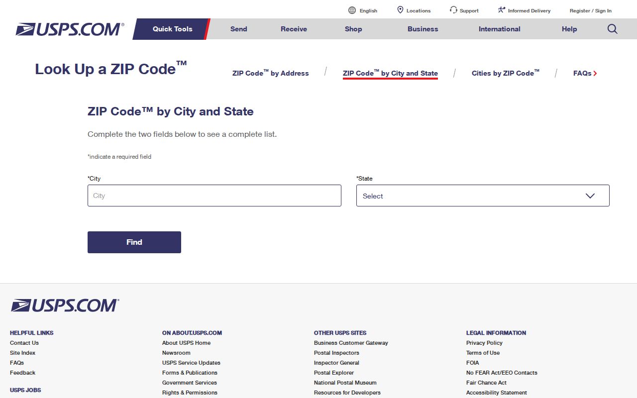
The captured USPS tool is the right place to confirm current delivery data. Record the search date because postal assignments and local portal records can change.
A city-and-state search and an address search answer different questions. The first tells which delivery codes are associated with the locality name. The second resolves the current code for one deliverable address. For a resident or parcel inquiry, the second result is stronger. Keep both the standardized address and the form originally supplied, since a county or historical database may store the older form.
Bloomington ZIP Versus ZCTA
USPS designs ZIP codes to route mail. The Census Bureau creates ZCTAs for statistics by grouping census blocks around the most common ZIP. Their edges can differ. A Bloomington mailing label may fall outside incorporated city limits, and a city service may be unavailable even though the postal city says Bloomington.
Do not turn a ZCTA into a neighborhood. Bloomington's neighborhood-association map is civic context, not a legal or postal boundary. County GIS identifies parcels across Monroe County. City Clerk, city uReport, and city planning records follow municipal jurisdiction. IU addresses can add a third custodian.
Finding Bloomington Residents by ZIP
A ZIP code directory narrows a search; it rarely identifies a person alone. Use each portal only for the role its record documents. Parcel data may show an owner and mailing address, voter data confirms registration under its access rules, and a business filing links a person to a public business role.
- Normalize the street direction, suffix, unit, city, state, and ZIP with the exact USPS address tool.
- Search Monroe County Beacon or parcel data by address, then capture the parcel ZIP and the separate owner-mailing ZIP.
- Use the Indiana voter site for personal registration confirmation, polling place, ballot, and county contact options.
- For city service records, filter Bloomington uReport by location or ZIP, then read its case date and status.
- Move from the code to an exact address or official record key before deciding two results concern the same person.
Once the result reaches a named road, use the Bloomington street directory for the address-to-parcel and deed-chain method.
Bloomington Parcel ZIP Fields
The Monroe ArcGIS parcel layer is unusually useful because it separates property fields from owner mailing fields. Its schema includes PropertyZip as well as Owner_City_ST_ZIP. A difference between them is not an error. It often means the owner's mail goes somewhere other than the parcel situs, which is the physical property address.
| Field or control | What it means | Safe use |
|---|---|---|
| PropertyZip | ZIP attached to the property street record | Map the parcel's recorded situs context |
| Owner_City_ST_ZIP | Combined owner mailing locality | Read as mailing data, not occupancy |
| Property_Street | Property street or situs field | Match an exact parcel address |
| PIN or tax ID | Parcel identifiers | Carry a match across GIS, tax, and deed research |
| Legal lot or subdivision | Land description fields | Distinguish close or changed street addresses |
The county assessor page supports owner, address, tax ID, sales, and record-print functions. Beacon is the current county-linked map route following the 2024 transition away from older Elevate instructions. If the web map fails, contact the Assessor or GIS Division and ask for the existing parcel record by address or identifier.
Bloomington uReport Geography
City uReport adds public service-request geography. Visible fields include location, ZIP, township, neighborhood, category, status, and description. These are service cases, not a resident list. They can show how the city classified a location and which department handled a reported issue.
The Bloomington uReport map search gives a visual geographic route.
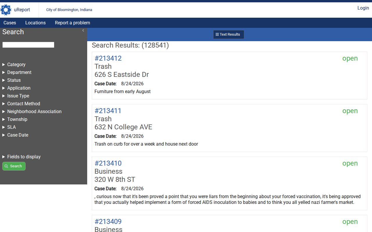
Pair its ZIP and neighborhood labels with the case date. Never treat a requester, description, or location as proof that a named person lives there.
Jurisdiction still controls the next step. City service data applies to Bloomington systems, while county parcels, deeds, courts, health records, and sheriff records have Monroe County custodians. IU has its own record routes. If a ticket search returns nothing, check whether the address is beyond the city line or on campus before changing the ZIP. A reasonably particular Indiana APRA request can identify an existing service case by date, location, number, category, and desired format.
The Bloomington 47407 Caution
An older USPS archive mentions 47407 in a Bloomington postal scheme. The current Census list used in the research shows 47401, 47403, 47404, 47405, 47406, and 47408 instead. Treat 47407 as a historical or unconfirmed lead.
For an old letter, directory entry, or form, keep the printed code and date in the notes. Then run the current exact address through USPS. Do not silently replace the old code, since that change may hide when a postal record was created.
Bloomington Address Search Terms
Small format differences can hide valid results. The postal form, GIS layer, business search, voter route, and city system do not share one parser. Try a controlled set of variants and record which one worked.
- Include or remove apartment and unit designators as the portal allows.
- Test directional forms such as North and N without changing the street itself.
- Use the standard suffix, then a common shortened form if no result appears.
- Separate a PO box from a street address and never treat it as the parcel situs.
- Check the mailing city and township when the code crosses a civic boundary.
Preserve the original form alongside the normalized version. That keeps an old directory or deed citation reproducible.
Historic sources need another check. A directory or plat may use an obsolete street name, old house number, or boundary from its publication year. Sanborn sheets and dated city maps can connect that form to a later address. Do not paste a modern ZIP into an old citation as if it were printed there. Store the historical wording, the modern standardized address, and the source dates as separate facts.
Bloomington ZIP Record Roles
Several official systems carry ZIP data, but each answers a different question. INBiz exposes address, city, ZIP, registered-agent, incorporator, and governing-person fields for business entities. A public role in a filing is not proof of residence. Indiana voter systems use registration categories and exclude protected or confidential records, including Address Confidentiality Program safeguards.
| Official source | ZIP-related use | What it cannot prove |
|---|---|---|
| USPS | Current delivery ZIP for an exact address | City limits or occupancy |
| Monroe GIS | Property ZIP and owner-mail fields | That an owner lives at the parcel |
| Bloomington uReport | Service-case ZIP and local area context | A resident roster |
| INBiz | Business address, city, ZIP, and public roles | Private home or current residence |
| Voter records | Registration administration under state rules | An unrestricted free-form directory |
When online access is unavailable, use the documented fallback. Contact county GIS or the Assessor for parcel data, the election office for lawful voter-record access, the city department for an existing service record, or the Secretary of State for business records. Under Indiana APRA, describe the existing record, date span, address, case, or parcel ID rather than asking an office to create a new resident directory.
Bloomington ZIP Terms Explained
Postal and census terms sound alike but serve separate systems. Defining them prevents a broad code from becoming a false claim about a street or person.
- ZIP code
- A USPS routing code for mail delivery, not a city boundary.
- ZIP+4
- A more precise delivery segment added to the five-digit code for an address or group.
- PO-box ZIP
- A code or delivery pattern serving post-office boxes rather than proving a street location.
- Unique ZIP
- A code assigned to a high-volume organization rather than a normal neighborhood area.
- Carrier route
- A delivery path used by USPS. It is not a resident roll.
- ZCTA
- A Census statistical area approximating common ZIP geography from census blocks.
The safest order is exact address, current USPS result, parcel jurisdiction, then the record custodian. Save the date and role of each hit. That makes the Bloomington ZIP code directory a useful geographic filter without overstating what any postal code reveals.