
Bloomington Neighbors Source Map
Official block research is assembled from several custodians. Monroe County GIS supplies parcel geometry and public owner, mailing, situs, tax, and legal-lot fields. Bloomington’s open data supplies civic neighborhood areas. uReport adds public service cases by location and neighborhood. Library maps add a dated view of how a block changed. None is a household roster, so each result must keep its own label and date.
| Public source | Block detail available | How access works |
|---|---|---|
| Monroe Beacon and ArcGIS | Target and adjacent parcels, owner and mailing fields, situs, lot, subdivision, tax district | Free county-linked map and public parcel layer; GIS disclaimer applies |
| City neighborhood layer | Named civic association areas registered mainly with HAND | Public open data; incomplete and not a legal boundary |
| Bloomington uReport | Public cases by place, ZIP, association, township, category, status, and date | Public map or text search; not a people list |
| MCPL and Monroe maps | Historic plats, Sanborn sheets, streets, precincts, and council districts | Library and online collections; map year controls meaning |
| Voter data request | Permitted registration fields under Indiana law | VRG-24 request, redactions, ACP, and use limits; no public block-name map found |
| Public meeting files | Board participants, applicants, comments, projects, and public civic roles | Case or meeting specific; role is not proof of residence |
This table also shows why a commercial compiled neighbor tool is not a substitute for local records. A compiled name can lack a clear date, source, or role. County and city sources disclose what each field means, who keeps it, and where to ask for correction.
Map Bloomington Neighbors by Parcel
Open the Monroe County Beacon viewer and search the exact address. The county moved from Elevate to Beacon during the winter 2024 migration, so older instructions may point to a retired interface. Select the target polygon, record its PIN or tax ID, and note the date. Then inspect only the polygons that actually touch or sit near it. Do not claim a one-mile radius unless the live map displays an official measurement.
- Normalize the street direction, suffix, unit, city, and ZIP before searching.
- Select the target parcel and save its PIN, property address, legal lot, subdivision, and map date.
- Click each adjacent polygon and record its owner and mailing fields as separate values.
- Check the Assessor or tax card when a parcel detail is incomplete.
- Compare the parcel pattern with the city’s civic neighborhood layer.
The flow is address to parcel, parcel to adjacent polygons, then polygons to dated public owner fields. That is narrower than a whole-street search. For a full named-street chain through deeds and address records, use the Bloomington street directory.
Read Bloomington Parcel Roles
The official ArcGIS schema separates Owner, Owner Street, and Owner City/State/ZIP from Property Street, Property City, and Property ZIP. The first group describes the tax-roll owner and mailing destination. The second describes the situs, meaning the physical parcel location. A trust, company, estate, or person can own the parcel, and the mailing address may be far from the site.
- Parcel
- A mapped unit of land tied to a public identifier and legal description.
- Situs address
- The physical address assigned to the property.
- Owner mailing address
- The destination used for owner or tax mail, which may differ from the situs.
- Plat
- A recorded map showing lots, blocks, easements, or subdivision layout.
- Adjacent parcel
- A separate polygon beside the target, not proof of any social or household relationship.
A homestead field may be consistent with owner use, but it can be stale or tied to an exemption filing. It still does not identify every resident. GIS lines are approximate, too. A deed, recorded plat, or survey controls a legal-boundary question.
Bloomington Neighborhood Associations
The City Neighborhood Associations dataset maps organizations registered primarily with Housing and Neighborhood Development, known as HAND. The City warns that the layer does not contain every neighborhood area. It can also include land outside city limits when part of an association lies inside. Treat the shapes as civic areas, not parcel, voter, school, postal, or legal boundaries.
| Examples on the official map | Best official route |
|---|---|
| Northwood Estates and Fritz Terrace | City open-data layer and neighborhoods map gallery |
| Garden Hill and High Point | HAND registration layer; verify current map date |
| Old Northeast and Broadview | City neighborhoods page and public organization contact, if posted |
| Southern Pines and Maple Heights | Official map for civic-area context, not a member list |
No complete public member directory, standard contact list, or single join form was found for every mapped group. Bloomington also distinguishes civic neighborhood associations from private homeowners associations and does not register or regulate every HOA. Search a specific group’s own public page or City record when a public contact is needed. Do not infer membership from a parcel that falls inside a colored shape.
Bloomington Block Activity Records
Bloomington uReport can place a public service case in block context without claiming anything about a household. Its public fields include location, coordinates, city, state, ZIP, description, neighborhood association, township, case date, category, department, status, and result sorting. A pothole, sanitation issue, tree concern, or other service ticket is a dated municipal record, not a directory entry for the person who lives nearby.
Planning Commission, zoning appeal, and council packets may also tie an applicant, owner, representative, public comment, plan, or decision to an address. Use the packet’s role, date, and status. For an existing city or county file that is not indexed online, make a focused Indiana Access to Public Records Act request with the address, parcel, case type, and date range. The agency need not create a new list of Bloomington neighbors.
Voter Rules for Bloomington Neighbors
No official public map of voter names by Bloomington block was located. The Indiana Voters portal is built for an identified voter to confirm registration and polling information. Broader voter-record access uses State Form VRG-24 through the county or state election office. Public fields remain subject to redaction, uniform county policy, request-use terms, and Address Confidentiality Program protection.
A voter record can show a dated registration relationship to an address. It does not show all people in the home, and it does not prove current occupancy. Indiana status concepts include Pending, Active, Inactive, and Cancelled. Full Social Security numbers, citizenship-proof documents, and ACP data are confidential. Parcel polygons must never be used to guess who is registered on a block.
Historic Bloomington Neighbors by Map
Modern parcels explain today’s mapped pattern, while old maps explain why a block looks that way. Monroe County Public Library and Indiana collections include Bloomington Sanborn fire-insurance maps for 1883, 1887, 1892, 1898, 1907, 1913, 1927, and 1927-1937. These sheets can show old house numbers, footprints, materials, uses, and nearby structures. Plat maps and the 1876 atlas add lot and boundary context.
Pair a map sheet with a dated city directory, deed, or census rather than reading an old occupant into a current parcel. Street numbers may change, and lots may split, combine, or enter city limits. Record the old name, current name, sheet, year, and repository. Historical Bloomington neighbors are publication-year or record-year entries, not a statement about the present block.
Official Bloomington Neighbor Sources
Official sources and commercial neighbor tools answer different questions. The official route is slower because it keeps the original custodian, field label, date, and legal limit visible. Commercial compilations may blend old address files, names, and inferred ties without a reliable update date. That can make a quick result look more certain than it is.
| Point of comparison | County and city records | Commercial compiled tools |
|---|---|---|
| Source | Named custodian and defined public field | Often mixed or unclear inputs |
| Date | Map, filing, case, or publication date can be saved | Refresh date may be hard to identify |
| Meaning | Owner, applicant, registrant, or civic role stays labeled | Different roles may appear together |
| Correction | Custodian or official vendor has a contact route | Removal and correction processes vary |
| Privacy | Statutory exclusions and redactions apply | Compilation can increase risk of a false match |
Use the county parcel map for adjacency, the city association layer for civic geography, and the proper custodian for a dated record. A name from any source still needs context before it can describe your neighbors.
Protect Bloomington Neighbors’ Privacy
Indiana’s Address Confidentiality Program gives eligible survivors a substitute mailing address for government mail and specified records. Participants must follow the notice process, and covered voter identifying information is confidential subject to narrow exceptions. Never join parcel, voter, association, directory, or social clues to expose a protected location.
Household members, utility customers, delivery records, driver addresses, private rosters, sealed court material, and protected vital data are not established by a parcel polygon. Public police and court files may also involve victims or sensitive events. Request only what is needed, preserve redactions, and describe an official record by its role and date. The Monroe Clerk records page illustrates the official access route and its court-record limits.
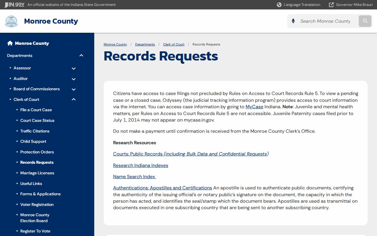
The Clerk’s guidance reinforces a key rule: a public case record remains case-specific, and adjacency alone does not mean people know one another.
Respect the block. Use Bloomington neighbor records for lawful civic and personal research, never to watch, contact, harass, intimidate, or expose anyone.